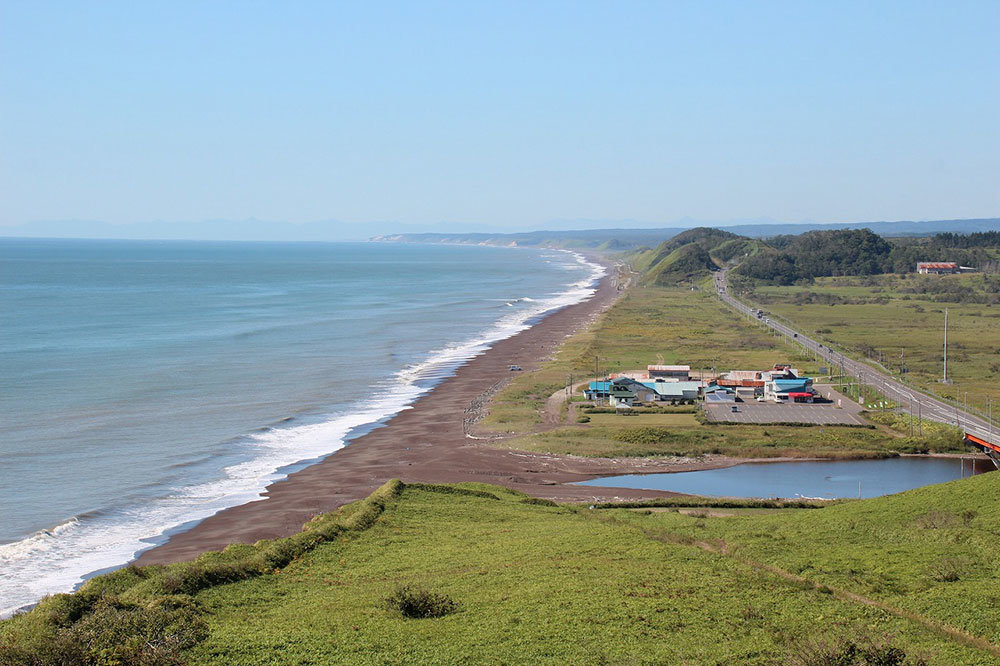
Pashikuru Natural Park
Located at the border of Shiranuka Town with Ombetsu, in Kushiro City, and facing the ocean, Pashikuru Swamp
and its surroundings was the field of the battle between Shiranuka Ainus and Akkeshi Ainus. It is also the
birthplace of Humperimse,
a traditional Ainu dance, and the place of many Ainu folktales. The name “Pashikuru” comes from the Ainu
language.
“Pashikuru” is the Ainu word for “raven”, but according to the ekashi (Ainu elders) and based on analysis of the
Ainu language and on folktales, the origin of the place name would be “pa (find)”, “shiri (land)”, and “kuru
(silhouette)”.
The tale of Pashikuru Swamp – Pashikuru coming from the Ainu word for raven
A long time ago, Ainu from Akkeshi arrived by canoe and attacked Kushiro and Shiranuka villages. The battle
turned out to the disadvantage of Shiranuka fighters, many of whom lost their life in the swamp. Raven then
gathered near the dead
bodies, which gave its name to the swamp. (Story told by the ekashi Mr NUKISHIO Kizo)
The tale of Pashikuru Swamp – Pashikuru meaning “I found a land”
A long time ago, a young man arrived from the west, bringing oyster larvae aboard his little boat. He was
looking for a place to breed them.
Suddenly, he was surrounded by fog and couldn’t see an inch ahead. Then he heard birds and followed their cries
until he saw land through the fog.
Unconsciously, the young man screamed “Pa shiri kuru (I found a land)!”
When he landed, he found a swamp and many ravens nearby. (Story told by the ekashi Mr NUKISHIO Kizo)
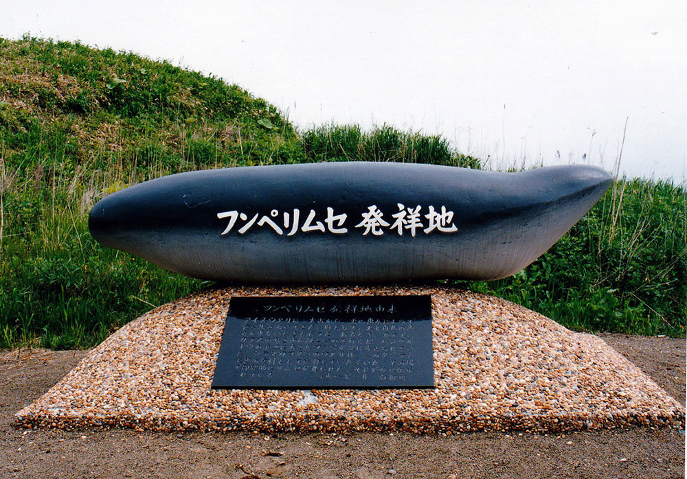
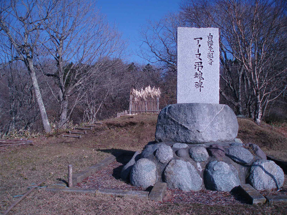
Birthplace of Humpe rimse
Humpe rimse (Whale dance) is a traditional Ainu dance, representative of Shiranuka. It comes from a folktale,
where Pashikuru shore is said to be its birthplace.
History of Humpe rimse
Since the ancient times, Ainu have lived by finding their food thanks to the blessings of gods, but there had
been times when divine and nature blessings were scarce. One day that the cries of the ravens coming from the
west were particularly
loud, the Ainu of Shiranuka kotan went to see where it came from. They found a large whale stranded on the beach
of Pashikuru Swamp. They decided to eat the whale, thanking the gods for their gift and started an impromptu
rimse (dance) on the
spot. This dance has been transmitted since then, as the Whale dance.
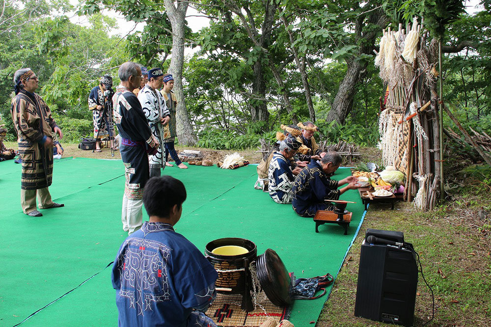
(Monument celebrating the birthplace of Humpe rimse, erected in January 1996 – Shiranuka Town). Shiranuka Ainu
Association organises every year in September a traditional ritual, Humpe Icharupa Festival (Whale Festival),
when “nusaonkami”,
“icharpa” and votive dances are performed in front of the monument.
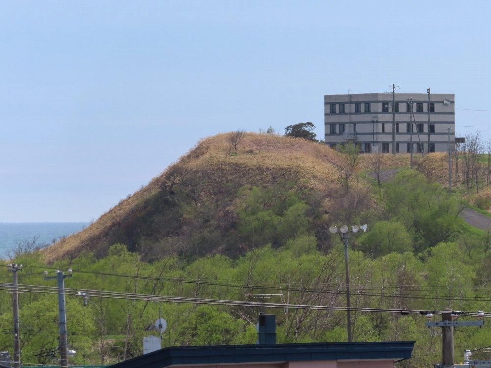
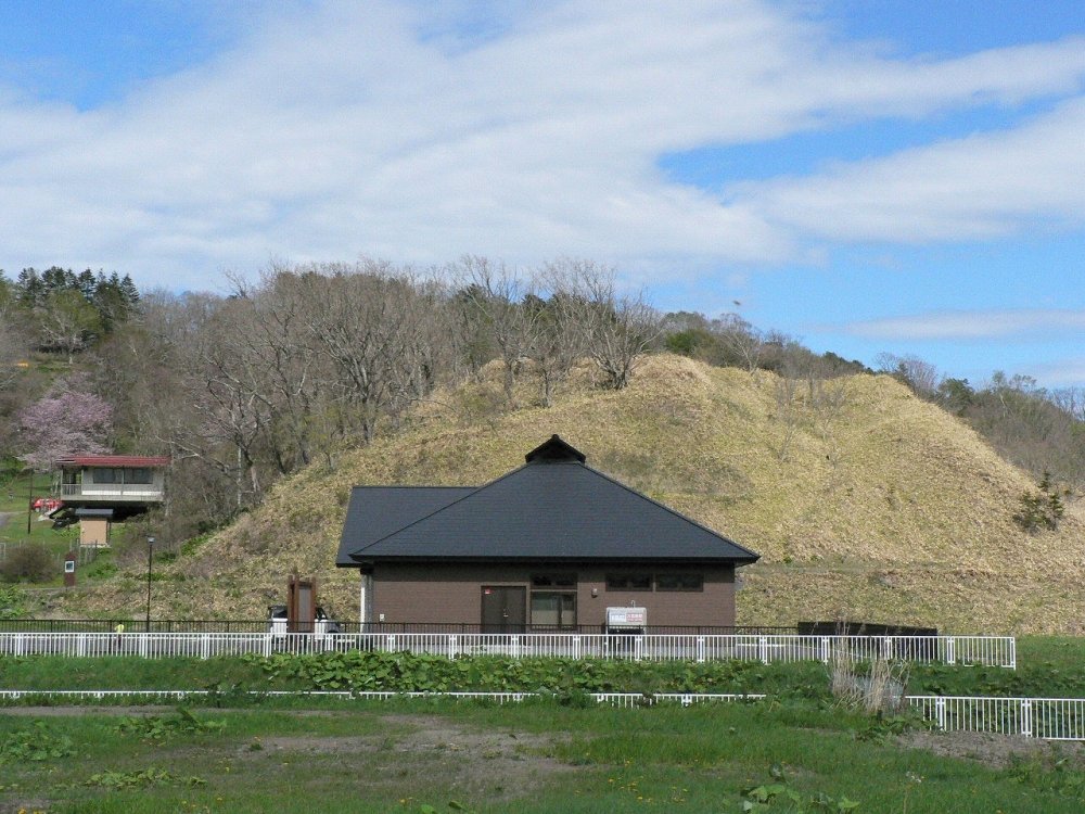
Sakanooka Chashi ruins
Sakanooka Chashi (fortifications) was a “hill-top chashi” with a trench, located at the south-east peak of
Sakanooka hill, a terrace in the western part of Shiranuka. Sakanooka Hill is 30 meters high and is shaped like
an isolated island,
facing the Pacific Ocean on its southern part, with Charo River on its eastern side, and Watenbetsu River on its
western side. It probably got separated from surrounding hills by the erosive action of the two rivers. Layers
yielded artefacts
have been found at each extremity of the hill, particularly at its eastern extremity, where Hokuto-type pottery
and stone and iron tools have been excavated. Sakanooka Hill was first named “Sakanogaoka” after the army
cavalry colonel SAKANO
Kinsaku who was the head of the Kushiro Branch of the department responsible for the management and supply of
war horses, which opened in November 1900. Nowadays, the northern half of the hill is occupied by the town’s
cemetery, while the
southern part is a privately-owned grazing land.
Misakinomori-Higashiyama Park
(known as “Higashiyama Park” for the
locals)
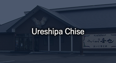
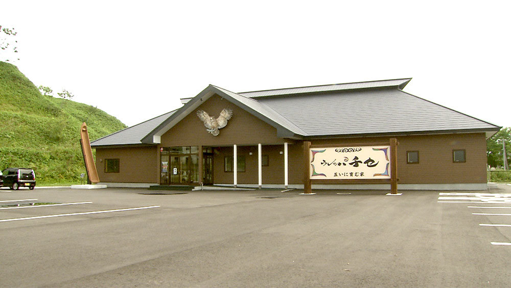
Ureshipa Chise
It is the center for cultural activities and provision of information regarding Shiranuka Ainu. It opened in
April 2018 at the foot of Higashiyama Park, which overlooks the Pacific Ocean.
For more information, consult our “Ureshipa Chise” page.
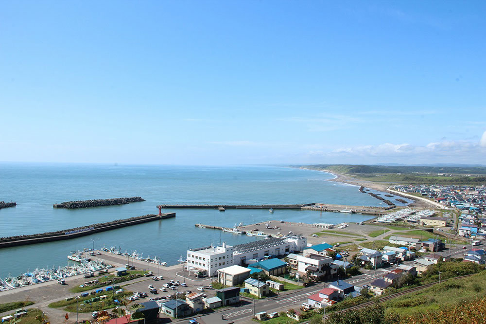
Shirieto Chashi ruins
Shirieto Chashi ruins are located in the south-western part of Higashiyama Park, on top of a 35-meter hill. As
it faces the Pacific Ocean on the south, and right beneath flows Okuneppu River, it is categorized as a
“seaside/riverside-type
hill-top chashi”. Research revealed the existence of fences and trenches’ remains.
An Ainu monument has been erected in the square adjacent to its northern side. It is there that in August every
year, “nusaonkami”, “icharupa” and votive dances are performed during Hometown Icharupa Festival.
Ruins of Cape Sekitan Chashi are located at the east of the hill, in direction of Kushiro City.
Cape Sekitan Chashi ruins
Cape Sekitan Chashi ruins are located in the south-east of Higashiyama Park (on Kushiro City side), on top of
the 45-meter-high cape. The aspect of the beach at the mouth of Shirarikappu River, which flows at the east of
the cape, gave its
name to Shiranuka.
Origin of the place name Shiranuka
Shiranuka comes from “Shirari (beach)” and “ka (top, pass over)” and means “near the rocky shore”, where waves
hit the beach and splash. This is this kind of scenery that can be observed at the rocky shores found between
the mouth of Okuneppu
River, which flows from the west to the south of Misakinomori-Higashiyama Park, and the mouth of Shirarikappu
River, at its east, which flows along Cape Sekitan, while Shiranuka fishing port is located between the two
mouths.
A tale: “The scent of the tide”
A long time ago, it was said that it was snowing even in summer on Ezo Island. But actually, snowfalls and sea
ice were rare in the warm season. But this time, it seemed that the snow that had been falling without a pause
since that winter
would never stop.
Days and days passed. Spring and summer passed, autumn arrived. But the mountains and valleys were still covered
with snow.
Voices of despair were constantly heard throughout the villages around. People were dying here and there because
deer were unusually few.
A piercing wind was blowing. It was the middle of autumn.
Covered in rags, an old Ainu had been walking for days from the kotan of Nemoro in the east when he reached the
coast. He was exhausted and sat on a piece of driftwood washed up on the shore. For days, he had had only water
to feed himself,
and he felt increasingly tired. Hot tears filled his eyes.
With heavy lids, he gazed at the waves crashing on the shore with white foam. He could just barely hear seabirds
squawking in the distance.
A small wave crashed on the shore. The old Ainu saw a piece of driftwood on a rock. Waves were crashing on other
waves, and then crashing on rocks.
Another wave arrived. It beat against the shore, it broke. But it still wasn’t reaching the piece of driftwood
on its rock.
After a while, the tide rushed in with a crestless wave and washed many of the rocks that had been until then
well above the sea level. The piece of driftwood was easily washed away. The tide then receded proudly, like a
victorious army.
Until a few moments ago, the water had been pouring everywhere and now small and larger rocks appeared before
him. Warm tears filled his eyes again, as he was witnessing the scene….
Even waves can wash over several times this tall rock. What about us… I shall work hard from now on to return
the kamuy’s favour…
Waves splash with intensity against the shore, they flow towards the beach and they recede.
Oh, shiraraika!
The old Ainu chose to settle here and make it his last resting place.
He was Shiranuka first inhabitant. It happened near the present Shiranuka River (Shirarikappu River).
(KOSUKEGAWA Hamao, in “Kushiro no umi ni”)
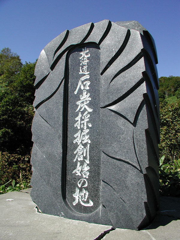
Management of coal mines by the Tokugawa shogunate: the beginning of coal mining extraction in
Hokkaido
It is believed that the name of Cape Sekitan comes from the fact that the Tokugawa shogunate directly exploited
and managed a coal mine (“sekitan”) there (1857-1864). Records show that Ainu worked in the mine. Before that,
the place was
called “Shiri-eto (land nose)”.
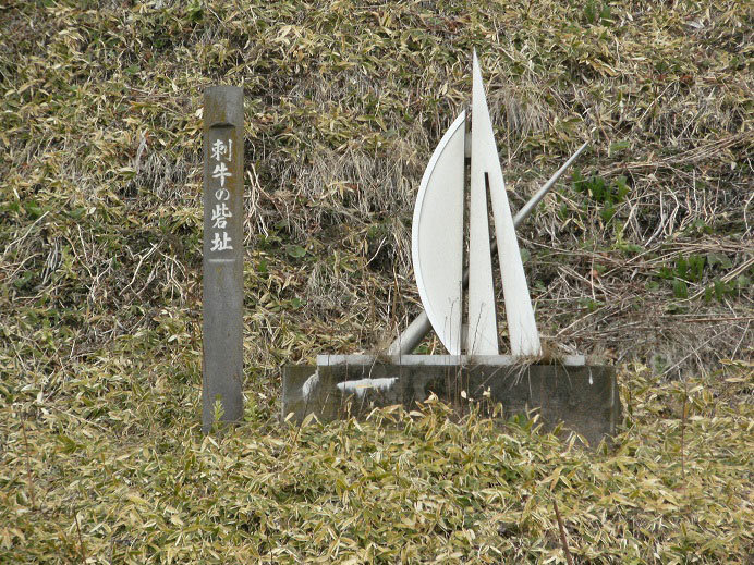
Sashiushi Chashi ruins
Sashiushi Chashi ruins are at the top of a 58-meter high cliff facing the Pacific Ocean, with a deep valley on
its eastern side, and a twofold trench and a mound on its western part. Relics from the Jomon period and the
Satsumon period up to
the Ainu cultural period have been excavated: stone tools (scraper, axe, etc.), satsumon pottery and iron tools
(billhook, “tashiro” knife, nails, cauldron, etc.). A monument, representing a bow and an arrow, has been
erected halfway up the
mountain were the chashi ruins are. Chashi is translated as “fortifications”, but it is in reality a special
place surrounded by fences were the kotan’s ceremonies, trials, councils, etc. are held, and it is also said to
be the heroes’ living
place and was used as fortifications only at emergency times. Sashiushi’s name comes from “sashi (kombu)” and
“ushi (grow in colonies)”, a testimony of its history as a place for kombu production.
A tale:"The woman head of Sashiushi Chashi"
A long time ago, a beautiful woman was the head of Sashiushi Chashi. Her name was Horupecha Kamuy Menoko and she
was so beautiful that people said she was Kandokoro kamuy (heavenly deity) who had descended to earth. She owned
a splendid
“shitoki” (breast plate) and this reached the ears of the head of Akkeshi who took his men with him on boats to
make a sudden attack in order to steal the ornament. Sashiushi Ainu were aware of Akkeshi Ainu’s chief ferocity
and prepared to
run away. However, Horupecha remained calm, stood at the centre of her Chashi, and just as she was addressing a
prayer to the deities asking for their help, a whirlwind raised and blew away like tree leaves the Akkeshi
fighters who were on
their way up to attack the Chashi. (Story told by CHIBA Nuifuchi)
Chinomi Nature Park
Koitoi Chashi ruins are located on a 50-meter high terrace, at about four kilometres from the mouth of Koitoi
River that flows in Shoro district. It is a “hill-top type” chashi with a trench, and that locals used to call
the “Ainu castle”,
while the swamp in front of the chashi was long referred to as the “swamp of the Ainu fort”.
Chinomi comes from the Ainu “chi” (we, us) and “nomi” (worship, pray) and it is the name of the place where
Ainu hold their « sending-off » (mono-okuri) ceremonies. It was probably a collective ritual site used by the
Ainu living in the
nearby “kotan” (villages).
As NAGATA Hōsei (1838-1911) wrote in his dictionary of place names of Ainu origin in Hokkaido (Hokkaido Ezo-go
chimei-kai), “Chinomi: ritual site, place where a bear is sacrificed to worship the gods », we understand that
it was a place where
“iomante” (bear sending-off) ceremony was held.
Surrounded by nature and located north of this ritual site, Chinomi Nature Park is a famous spot for cherry
blossoms.
Chinomi Chashi ruins
Chinomi Chashi ruins are located on a terrace at the east of Shoro River, at an elevation of 10 to 12 metres. In
addition to a one-metre-wide and 70-centimetre-deep trench, a pit-dwelling has been found at the site, where
“emus” (swords) and
“emusat” (sword holding strap) have been excavated. These are also a testimony that Chinomi was a ritual place
used for sending-off ceremonies.
Origin of the place name Shoro
The name of Shoro, where Chinomi is located, comes from the Ainu “so” (waterfall), “oro” (heading to) and “ru”
(path), that is the “path heading to the waterfall”. And as the name suggests, there is a waterfall, Ōtaki, at
about thirty
kilometres upstream from the mouth of Shoro River.
The fall is now of only about five metres high as people, when they used to transport timber on Shoro River, cut
the rocks nearby to make the waterfall basin shallower to ease transportation, but, according to MATSUURA
Takeshirō in his Diary
of Eastern Ezo (Higashi Ezo Nisshi), the fall used to be 15 to 18 metres high.
A tale:"Yoshitsune and Benkei’s lifting stones"
There is a waterfall upstream Shoro River. And at its top can be found Penke-iwa (upper rock), at its bottom,
Panke-iwa (lower rock).
A long time ago, while Yoshitsune (a famous shōgun of the 12th century) and his retailer, Benkei, were taking a
rest during a hunt, Yoshitsune decided to test his strength with Benkei who always boasted of his own strength.
Yoshitsune lifted
with ease a rock that Benkei hadn’t been able to lift and threw it at the top of the waterfall, while Benkei
could only but drop a small rock.
The rock that Yoshitsune threw at the top of the waterfall is Penke-iwa, and the one Benkei dropped is
Panke-iwa.
(Story told by YAMAMOTO Jinkichi, in Kushiro Municipal Library newsletter)
A tale:"Hell’s Hole in the upstream of Shoro River"
Since ancient times, it was said that there was a hole upstream Shoro River, which lead to Akan, and that it
probably was “omanruropa”, the entrance to the other world.
Once, two dogs were chasing a bear. The bear escaped into the hole, followed by the two dogs. One of them
succeeded to pass through and emerged after the bear at the bottom of Akan, the other did not reappear.
This is why people say there are two paths inside the hole, one of them leading to the other world.
(Story told by KUSAKA Yuki)
Koitoi Chashi ruins
Koitoi Chashi ruins are located on a 50-meter high terrace, at about four kilometres from the mouth of Koitoi
River that flows in Shoro district. It is a “hill-top type” chashi with a trench, and that locals used to call
the “Ainu castle”,
while the swamp in front of the chashi was long referred to as the “swamp of the Ainu fort”.
Origin of the place name Koitoi
The place name “Koitoi” comes from the Ainu “koi” (wave) and “tuie” (break, fall apart). It can be translated as
“rushing waves break the sand dunes (the land), and flow into the rivers and swamps”. It represents the moment
when raging waves
break sand dunes and flow into a river that doesn’t pour straight into the sea, but flows on the land side
alongside the coastline, its course hindered by the dunes.
A tale:"Koitoi Marsh divinity Iwa"
Shoro was known as a peaceful kotan, where life was good, with many fish living in Koitoi Marsh, such as
big-scaled redfins or crucian carps, and many edible plants, such as “ubayuri” (wild lily) or “kitobiro”
(Siberian onion), growing in the
nearby mountains. Other Ainu were envious of the place.
In the kotan lived an old woman who was known for her “tusu” (divination) skills.
What happened is that one night, she ran around in the kotan, with dishevelled hair and screaming repeatedly
“Opun-unpe eku” (the tsunami is coming!).
At first, people in the kotan didn’t really pay attention to her, but as she was screaming louder and louder,
knocking frantically at their doors: “If you don’t leave know, you are all going to die!”, they felt uneasy and
fled to the mountain
behind. And only a few moments later, they saw the sea rise offshore, and, before they knew it, a wave, big as a
mountain, swept everything away before their eyes.
They were all very happy to be still alive and grateful to the old woman. But she had disappeared, and they were
to never see her again.
What we learned later is that there was a big rock standing in the valley at the end of the marsh. And all were
convinced that the old woman had become the rock, and they raised their inaw (ritual stick) to worship the kamuy
iwa (rock
divinity).
A tale:"The Lord of Koitoi Marsh"
Koitoi Marsh did not have a name and was simply referred to as “toh” (marsh).
A weird thing about this marsh is that even if it is inhabited by many kinds of fish, there is no crucian
carp.
One day, a little stringfish went up Koitoi River and ended up in the marsh. Poor thing!
Many crucian carps were living in the marsh and they hurt the little stringfish so badly it was left all but
dead, but it succeeded in drifting back to the sea.
Finding it, its parents got very upset and gathered all their fellow stringfish to go and kill all the crucian
carps. Then, they stayed in the marsh and the little stringfish’s dad became the lord of the place.
This is why there are no crucian carp anymore in Koitoi Marsh.